| Views
of Auchonvillers
Looking west from Beaumont Hamel cemetery near the Sunken Lane. The village of Auchonvillers runs along the furthest ridge. 10 rue Delattre is behind the low grey building in the middle. The closer left hand ridge hides the communication trench called Second Avenue which descends from the south end of the village. The white cross is the 8th Argyll and Sutherland Highlanders memorial and is very close to the site of their battalion Headquarters on 13th November 1916. This was on the opposite side of the farm track at the bottom of the lane. The cemetery holds men from battalions of the 29th Division who were killed on 1st July 1916, in particular of the 1st Lancashire Fusiliers who attacked from both the Sunken Lane and the British front line at zero hour on that morning. Many were shot down by concentrated machine gun fire in front of the lane and only fifty or so got as far as the area where the cemetery now is. During the day the battalion lost 8 officers and 156 other ranks and not a single man got into the German positions. The battalions of this regiment were awarded eighteen Victoria Crosses during this war. 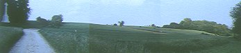
Panorama looking from the Sunken Lane (left), across no-mans-land and the Beaumont Hamel cemetery (center right) to the German front line (trees right).
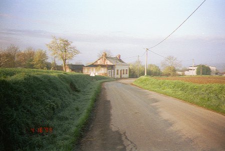
Station buildings at Auchonvillers. These served the French civilian metre gauge line which was still running through to Albert in 1915, although trains only ran infrequently and at night. Much of the ammunition for the Somme offensive was brought up on this line. The offloaded shells were then carried to the gun positions by fatigue parties. When the British arrived in July 1915 they used the station as a dressing station. This was later moved to a large farm at the western end of the village. The railway is now gone and the station buildings are used as a house. Comparision with aerial photographs suggests that it is the original pre-1914 building.
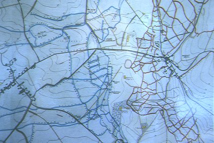
Modern map, compiled from original trench maps, showing positions in 1916. British trenches in blue, German trenches in red. Auchonvillers is on the left hand side of the map and 10 Rue Delattre is on the left of the road running northwest to the crossroads in the centre of the village. Beaumont Hamel is just behind the German trenches. The Hawthorn Ridge mine crater is just to the right of centre, below the pale green rectangle which is the Beaumont Hamel cemetery. Newfoundland Park is the area between the trenches at the bottom of the map. 
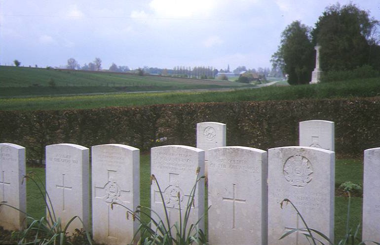
Auchonvilliers military cemetery. Whereas the Beaumont Hamel cemetery is situated on the front line, close to where the soldiers were killed, this cemetery contains many men who were evacuated and died of wounds. The "Red Barn" dressing station is on the right hand side out of the picture. The cemetery also contains the graves of men killed during the routine of trench warfare by artillery and trench mortars. A number of men from 252 Tunnelling Company, Royal Engineers are buried here. They were killed by German countermines in the vicious mine war that took place under Redan Ridge in 1915 and 1916. Other casualties include men of the New Zealand, Royal Naval, 12th and 17th Divisions who were killed nearby in 1918. |
|